In the early 1860's, America's railway system went only as far West as Missouri. It would be another nine years before the country was joined together for the first time--by rail--when the Central Pacific and the Union Pacific lines met at Promontory, Utah on May 10, 1869.
By 1903, six more transcontinental lines were established, including
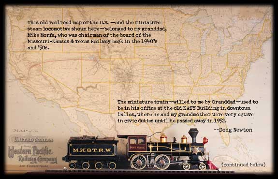
the Western Pacific route--shown above on "Granddad's map" in red--which ran through Antelope, Winnemucca, Red Rock and other little Western towns before joining up with the Denver & Rio Grande line at Salt Lake City. If you look closely, you can see how the states of Nevada and California were "stretched" a bit to accommodate the names of each and every whistle-stop along the route.
|